Global Navigation Satellite System (GNSS); Tide Gauge; Sea Level; Vertical Land Movements
Abstract :
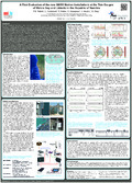
[en] During September 2015 the Hartebeesthoek Radio Astronomy Observatory in collaboration with the University of Luxembourg installed two state-of-the-art continuous GNSS stations adjacent to the tide gauges of Walvis Bay and Lüderitz in the Republic of Namibia. These installations are the culmination of a four-year effort to get the stations established and the help of the Namibian Port Authority in this endeavour is much appreciated. The tide gauge at Walvis Bay (Global Sea Level Observing System (GLOSS) number 314) has a record in the Permanent Service for Mean Sea Level (PSMSL) Revised Local Reference (RLR) database (number 914) dating back to 1958 (data completeness 54%). The tide gauge at Lüderitz is not a GLOSS station but also has a PSMSL RLR record (number 911) since 1958 (data completeness 67%). Both tide gauges currently use a radar measurement unit and are operated by the Hydrographic Office of the South African Navy. They are the only sea level observations along a more than 3000 km stretch of the West African coast from Pointe Noire in the Republic of the Congo to Port Nolloth in the Republic South Africa, hence they form an important data source for sea level studies.
The two continuous GNSS stations record observations from all visible GNSS satellites (GPS, GLONASS, BDS and Galileo) with a 1 second recording interval. The current installations support hourly data downloads, which are sufficient for most activities within the IGS, while the data have great potential to contribute not only to the TIGA working group but also to MGEX. In this study we present the first evaluation of the quality of the GNSS observations from the two new continuous GNSS stations for the first three months of operation. In the future we plan to make the data available to the scientific community.
Disciplines :
Earth sciences & physical geography
Author, co-author :
Teferle, Felix Norman ; University of Luxembourg > Faculty of Science, Technology and Communication (FSTC) > Engineering Research Unit
Combrinck, Ludwig; Hartebeesthoek Radio Astronomy Observatory, South Africa
Botha, Roelf; Hartebeesthoek Radio Astronomy Observatory, South Africa
Hunegnaw, Addisu ; University of Luxembourg > Faculty of Science, Technology and Communication (FSTC) > Engineering Research Unit
Abraha, Kibrom Ebuy ; University of Luxembourg > Faculty of Science, Technology and Communication (FSTC) > Engineering Research Unit
Ding, Wenwu ; University of Luxembourg > Faculty of Science, Technology and Communication (FSTC) > Engineering Research Unit
External co-authors :
yes
Language :
English
Title :
A First Evaluation of the new GNSS Station Installations at the Tide Gauges of Walvis Bay and Lüderitz in the Republic of Namibia